ESCONDIDOPEDIA
19 capítulos con fuentes

Recorre la historia de Escondido

Esta cronología comienza con evidencia de vida humana en la región desde hace milenios. Seis capítulos centran la historia indígena, tres siguen experiencias de inmigrantes, dos hacen visible la memoria latina y mexicoamericana, siete recorren cambios de tierras, ciudad y gobierno, y uno vuelve a la cultura viva y la memoria comunitaria. Las fechas marcan la cobertura de las fuentes, no el comienzo de un pueblo. Ver más fotos históricas en el Escondido History Center.

Capítulo 1 de 19: Hace unos 10.000 años, La evidencia arqueológica se remonta unos 10.000 años

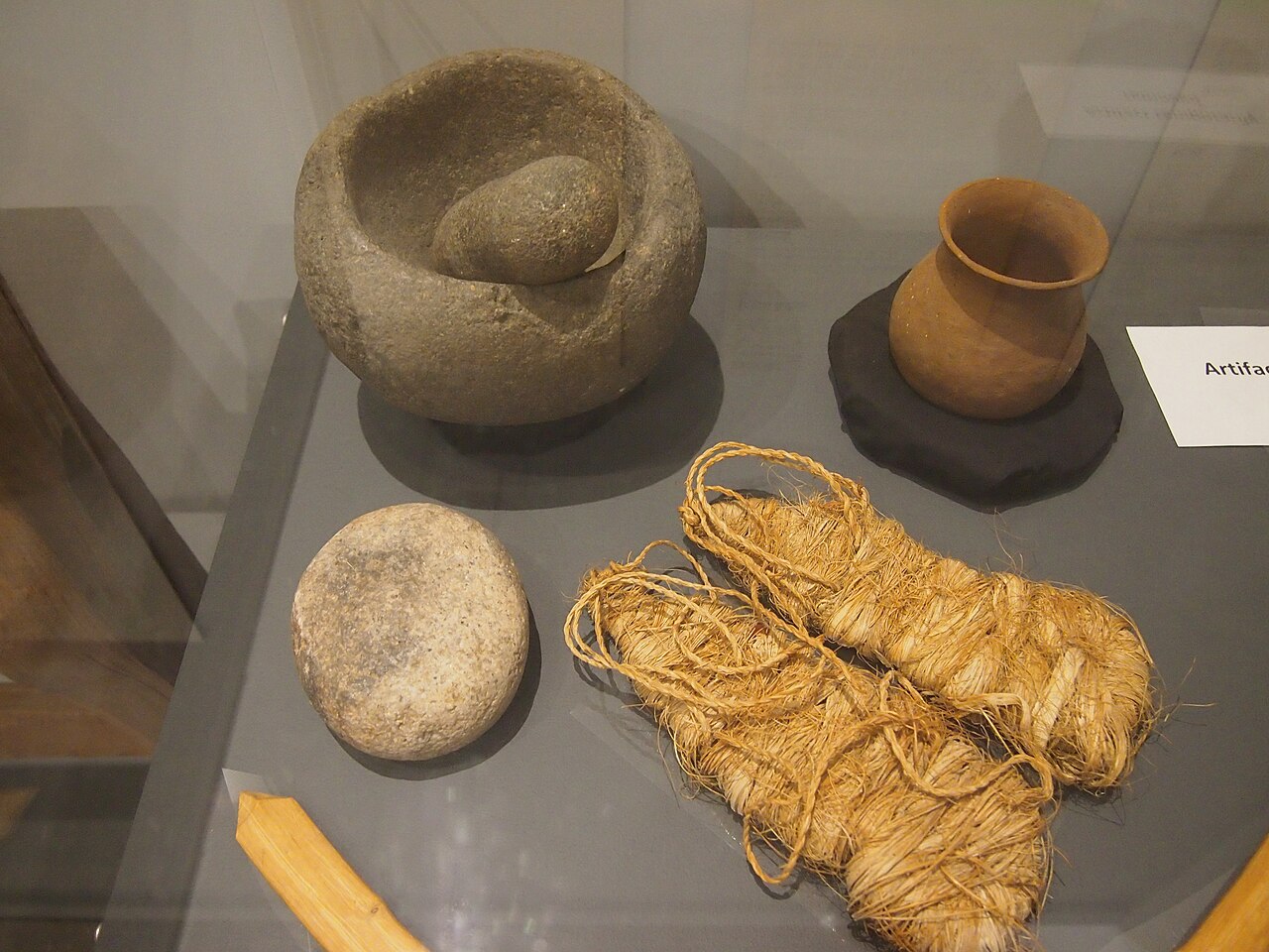
  1. Stone mortar and pestle, ceramic vessel, and fiber materials arranged in a museum display.

    Capítulo 1 de 19 · Historia indígena

    Hace unos 10.000 años

    La evidencia arqueológica se remonta unos 10.000 años

    Una revisión de recursos culturales de la Ciudad de 2012 fecha la evidencia arqueológica regional en unos 10.000 años. Ese es el alcance de la evidencia resumida en el informe, no el comienzo de la historia indígena; la arqueología no reemplaza los relatos tribales.

    Fuentes: City of Escondido Cultural and Paleontological Resources (City of Escondido)

    Lee la historia con fuentes

    Contexto y crédito de la imagen (en inglés)

    This museum display includes a stone mortar and pestle and other Kumeyaay material culture. It shows the kinds of material evidence archaeology studies, not a dated Escondido find; the report's 10,000-year date comes from the cited City review.

    A museum display described by the photographer as part of a San Diego history collection includes a stone mortar and pestle and other Kumeyaay material culture. It is museum context, not a dated Escondido archaeological find.

    Crédito
    Photo by Slowking, CC BY-NC 3.0, via Wikimedia Commons. Local copy uses Wikimedia's 1280px resized file; no Escondidopedia edits.
    Creador
    Slowking
    Licencia
    CC BY-NC 3.0
    Fuente
    https://commons.wikimedia.org/wiki/File:Kumeyaay_display_115408_-.JPG
    Original
    https://upload.wikimedia.org/wikipedia/commons/thumb/f/f8/Kumeyaay_display_115408_-.JPG/1280px-Kumeyaay_display_115408_-.JPG
    Reutilización
    Noncommercial reuse only under CC BY-NC 3.0; retain attribution and license link. Do not present the display as a dated Escondido excavation or disclose archaeological-site provenance.
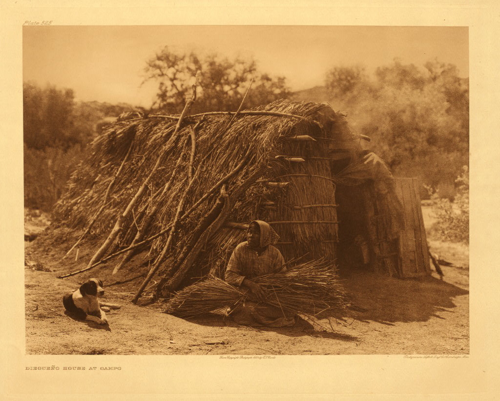
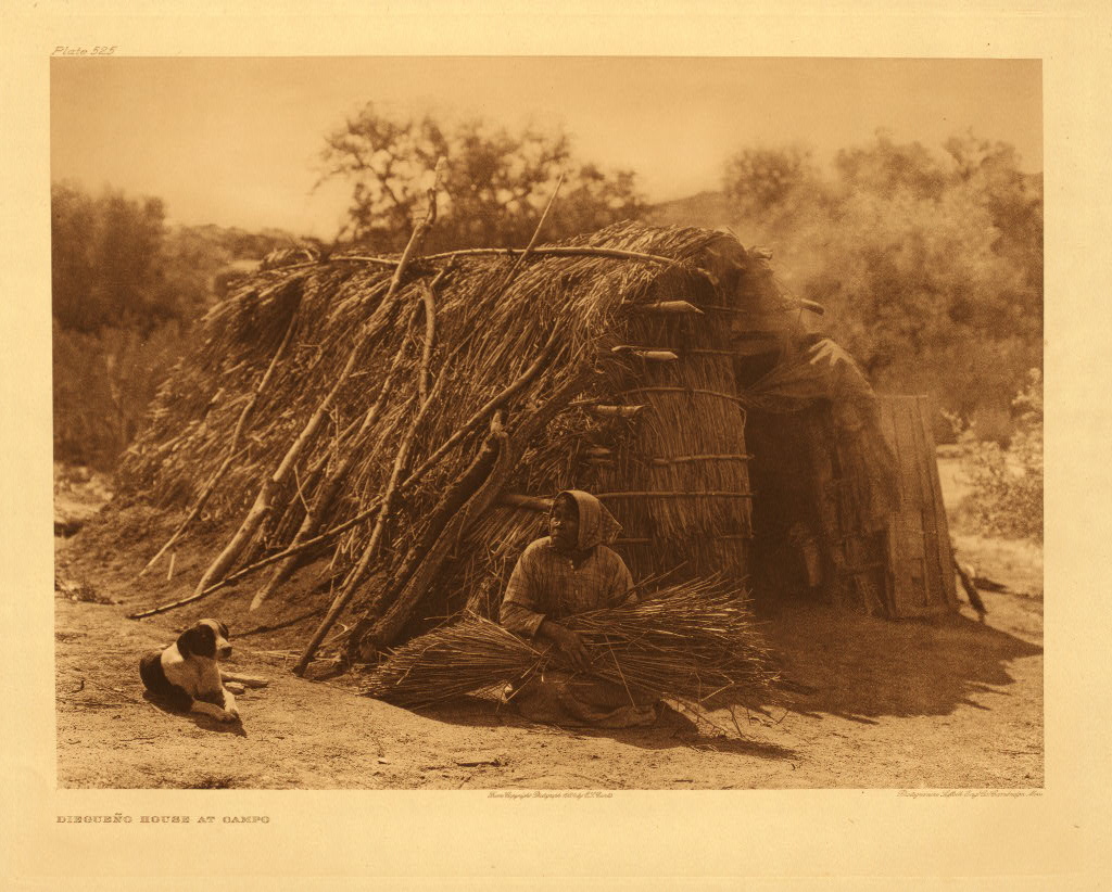
  2. Sepia-toned photograph of a Kumeyaay woman seated with gathered plant material beside a brush house at Campo, with a dog nearby.

    Capítulo 2 de 19 · Historia indígena

    Desde hace unos 1.300 años hasta 1769

    Comunidades Kumeyaay y Luiseño vivían en toda la región

    La revisión de la Ciudad describe aldeas permanentes o estacionales, lugares para moler bellotas, redes de intercambio y uso sostenido de recursos locales. Distingue las culturas Kumeyaay y Luiseño, pero advierte que los artefactos no permiten trazar fronteras culturales simples.

    Fuentes: City of Escondido Cultural and Paleontological Resources (City of Escondido)

    Lee la historia con fuentes

    Contexto y crédito de la imagen (en inglés)

    Edward S. Curtis published this Campo photograph of an unnamed Kumeyaay woman in 1926. It offers human and built-environment context but is much later than the chapter, comes through an outside ethnographic lens, and does not represent Luiseño people or pre-1769 life.

    Edward S. Curtis photographed an unnamed Kumeyaay woman at Campo in an image published in 1926. The photograph is later than this chapter’s pre-1769 period and is not evidence of unchanged lifeways.

    Crédito
    Edward S. Curtis, published 1926, from The North American Indian. Northwestern University Library via Wikimedia Commons; public domain in the United States.
    Creador
    Edward S. Curtis
    Licencia
    Public domain in the United States
    Fuente
    https://commons.wikimedia.org/wiki/File:Edward_S._Curtis_Collection_People_074.jpg
    Original
    https://upload.wikimedia.org/wikipedia/commons/5/5a/Edward_S._Curtis_Collection_People_074.jpg
    Reutilización
    Retain the 1926 date and ethnographic-photography context; do not present the image as pre-contact life, an Escondido scene, or an account of Luiseño people.
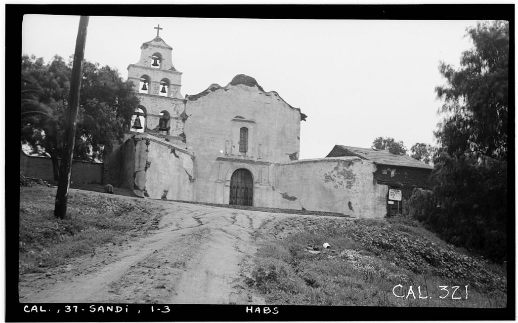
  3. Black-and-white 1936 photograph of Mission San Diego de Alcalá’s weathered south façade and bell tower beside an unpaved approach.

    Capítulo 3 de 19 · Historia indígena

    1769 a 1821

    La Misión San Diego desplazó al pueblo Kumeyaay y sus grupos entraron al valle

    La Banda de San Pasqual relaciona directamente la Misión San Diego con el desplazamiento Kumeyaay y la presión para convertirlos. Una revisión de la Ciudad dice que el Valle de Escondido no estaba bajo la jurisdicción formal de ninguna de las dos misiones cercanas, aunque sus grupos entraban en busca de trabajadores y conversos indígenas. La vida Kumeyaay continuó.

    Fuentes: History (San Pasqual Band of Mission Indians) · City of Escondido Cultural and Paleontological Resources (City of Escondido)

    Lee la historia con fuentes

    Contexto y crédito de la imagen (en inglés)

    This 1936 federal survey photograph documents Mission San Diego de Alcalá after recorded 1930–1931 work. The San Pasqual Band directly names this mission in its history. The image shows later architecture, not mission-period conditions or Native experience. The City review also names Mission San Luis Rey, but says the Escondido Valley was under neither mission's formal jurisdiction.

    Mission San Diego de Alcalá’s south façade in a December 1936 Historic American Buildings Survey photograph.

    Crédito
    Henry F. Withey, Historic American Buildings Survey, December 1936. Library of Congress, HABS CAL,37-SANDI,1--3.
    Creador
    Henry F. Withey for the Historic American Buildings Survey
    Licencia
    No known restrictions (Historic American Buildings Survey)
    Fuente
    https://www.loc.gov/pictures/item/ca0607.photos.015251p/
    Original
    https://tile.loc.gov/storage-services/service/pnp/habshaer/ca/ca0600/ca0607/photos/015251pv.jpg
    Reutilización
    The Library of Congress reports no known restrictions on images made by the U.S. Government; retain the 1936 date and do not present the photograph as a mission-period scene.
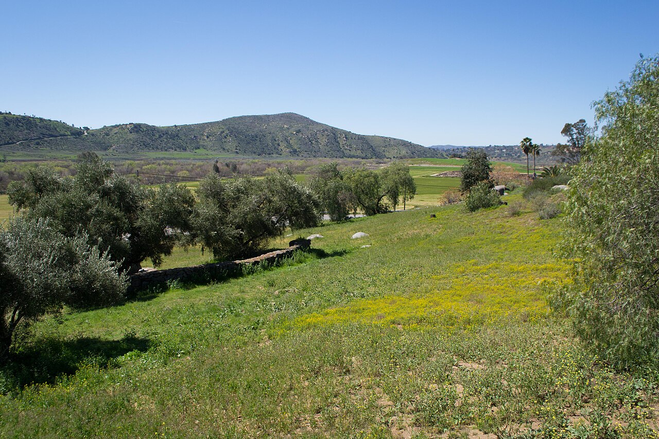
  4. Present-day view across the green floor and low hills of San Pasqual Valley.

    Capítulo 4 de 19 · Historia indígena

    1835

    Ochenta y una personas Kumeyaay establecieron el Pueblo de San Pasqual

    La Banda de San Pasqual registra a 81 hombres, mujeres, niños y niñas en el nuevo Pueblo. El censo incluía vaqueros, arrieros, carpinteros, tejedores, agricultores, curtidores, un herrero y otros trabajadores calificados.

    Fuentes: History (San Pasqual Band of Mission Indians)

    Lee la historia con fuentes

    Contexto y crédito de la imagen (en inglés)

    This 2013 view shows San Pasqual Valley, the place named in the Band's history. It does not locate or reconstruct the 1835 Pueblo or identify the 81 residents.

    San Pasqual Valley in 2013. The view establishes the place named in the San Pasqual Band’s history; it does not locate or reconstruct the 1835 Pueblo.

    Crédito
    Photo by Visitor7, CC BY-SA 3.0, via Wikimedia Commons. Local copy uses Wikimedia's 1280px resized file; no Escondidopedia edits.
    Creador
    Visitor7
    Licencia
    CC BY-SA 3.0
    Fuente
    https://commons.wikimedia.org/wiki/File:San_Pasqual_Valley.jpg
    Original
    https://upload.wikimedia.org/wikipedia/commons/thumb/0/0e/San_Pasqual_Valley.jpg/1280px-San_Pasqual_Valley.jpg
    Reutilización
    Reuse under CC BY-SA 3.0 with attribution and share-alike terms; do not infer the Pueblo’s precise location from this modern view.
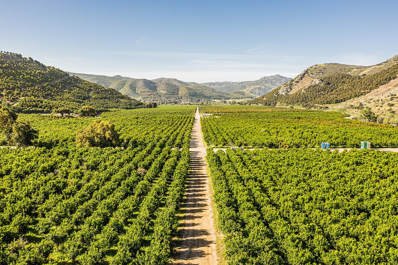
  5. Aerial view along rows of a green citrus orchard between the hills of San Pasqual Valley.

    Capítulo 5 de 19 · Historia indígena

    1837 a la década de 1860

    Panto dirigió una próspera aldea agrícola Kumeyaay

    La Banda de San Pasqual dice que San Pasqual prosperó durante casi treinta años bajo el liderazgo de Panto. Sus residentes criaban ganado con ranchos californios, intercambiaban trabajo por ganado y caballos y construyeron una presa para un ranchero vecino.

    Fuentes: History (San Pasqual Band of Mission Indians)

    Lee la historia con fuentes

    Contexto y crédito de la imagen (en inglés)

    This 2021 aerial shows a modern citrus orchard in San Pasqual Valley. It makes the agricultural setting visible but does not depict Panto's village, its residents, stock, crops, or dam.

    A modern citrus orchard in San Pasqual Valley. It illustrates the valley’s agricultural landscape, not Panto’s nineteenth-century village or its crops.

    Crédito
    Photo by Mark Skovorodko, CC BY-SA 4.0, via Wikimedia Commons. Local copy uses Wikimedia's 1280px resized file; no Escondidopedia edits.
    Creador
    Mark Skovorodko
    Licencia
    CC BY-SA 4.0
    Fuente
    https://commons.wikimedia.org/wiki/File:Mark_Skovorodko_Photography_-_San_Pascual_Valley_Orchard_Escondido.jpg
    Original
    https://upload.wikimedia.org/wikipedia/commons/thumb/a/ad/Mark_Skovorodko_Photography_-_San_Pascual_Valley_Orchard_Escondido.jpg/1280px-Mark_Skovorodko_Photography_-_San_Pascual_Valley_Orchard_Escondido.jpg
    Reutilización
    Reuse under CC BY-SA 4.0 with attribution and share-alike terms; retain the modern-date caveat and do not present the orchard as Panto’s village.
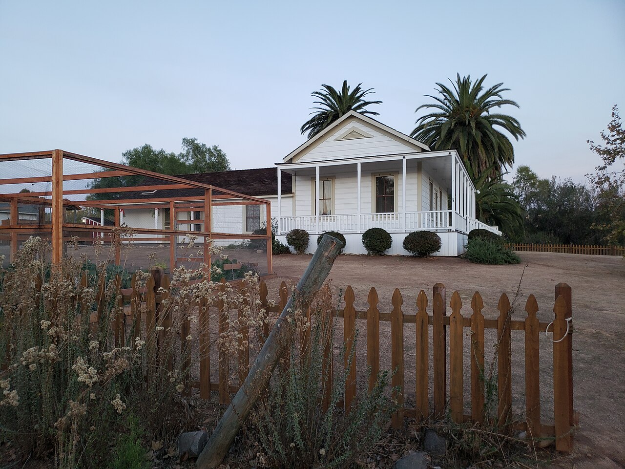
  6. White historic farmhouse at Sikes Adobe Historic Farmstead seen behind a wooden fence and garden plantings.

    Capítulo 6 de 19 · Tierras, ciudad y gobierno

    1843 a 1848

    Una concesión mexicana de tierras entró a un nuevo sistema de propiedad de Estados Unidos

    Una revisión de la Ciudad dice que Juan Bautista Alvarado recibió El Rincón del Diablo en 1843. Después de que California pasó a Estados Unidos en 1848, los costos legales y los requisitos para probar títulos contribuyeron a dividir muchos ranchos mexicanos.

    Fuentes: City of Escondido Cultural and Paleontological Resources (City of Escondido)

    Lee la historia con fuentes

    Contexto y crédito de la imagen (en inglés)

    Sikes Adobe was built later, around 1870. It illustrates a later agricultural farmstead, not Alvarado's rancho buildings or land boundaries.

    Sikes Adobe Historic Farmstead viewed from Mule Hill Trail.

    Crédito
    Photo by RightCowLeftCoast, CC BY-SA 4.0, via Wikimedia Commons. Local copy uses Wikimedia's 1280px resized file; no Escondidopedia edits.
    Creador
    RightCowLeftCoast
    Licencia
    CC BY-SA 4.0
    Fuente
    https://commons.wikimedia.org/wiki/File:Sikes_Adobe_Historic_Farmstead_-_3.jpg
    Original
    https://upload.wikimedia.org/wikipedia/commons/thumb/3/32/Sikes_Adobe_Historic_Farmstead_-_3.jpg/1280px-Sikes_Adobe_Historic_Farmstead_-_3.jpg
    Reutilización
    Reuse under CC BY-SA 4.0 with attribution, license link, share-alike for adaptations, and change indication if modified.
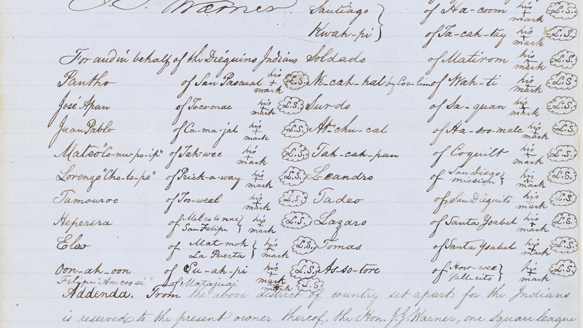
  7. Crop of the handwritten 1852 treaty signature sheet showing Pantho of San Pascual in the left column and a cross recorded as his mark.

    Capítulo 7 de 19 · Historia indígena

    1852 a 1878

    Acciones de Estados Unidos despojaron y dispersaron al pueblo de San Pasqual

    La Banda de San Pasqual dice que representantes Kumeyaay negociaron el Tratado de Santa Ysabel en 1852, pero el Senado de Estados Unidos lo rechazó. Estados Unidos anuló una reservación de San Pasqual en 1871 y las autoridades del condado expulsaron a la gente de San Pasqual del valle en 1878.

    Fuentes: History (San Pasqual Band of Mission Indians)

    Lee la historia con fuentes

    Contexto y crédito de la imagen (en inglés)

    This crop from the original handwritten 1852 Treaty of Santa Ysabel shows “Pantho, of San Pascual” and the cross recorded as his mark. It documents the treaty itself, not the later reservation rescission or 1878 removal. Historical spelling and terminology are reproduced from the federal record.

    The original handwritten 1852 Treaty of Santa Ysabel records ‘Pantho of San Pascual’ with a cross as his mark.

    Crédito
    National Archives and Records Administration, Records of the Bureau of Indian Affairs, Record Group 75, Unratified Treaty File, Treaty L, NAID 245237956, image 5.
    Creador
    United States Office of Indian Affairs
    Licencia
    Public domain (United States federal record)
    Fuente
    https://catalog.archives.gov/id/245237956
    Original
    https://catalog.archives.gov/medialz/dc-metro/rg-075/300293/RG-75-300293-UTF_1_029/RG-75-300293-UTF_1_029-005-ac.jpg
    Reutilización
    The National Archives catalog marks access and use unrestricted. Retain the unratified-treaty context; the local image is a crop of image 5, with no text altered.
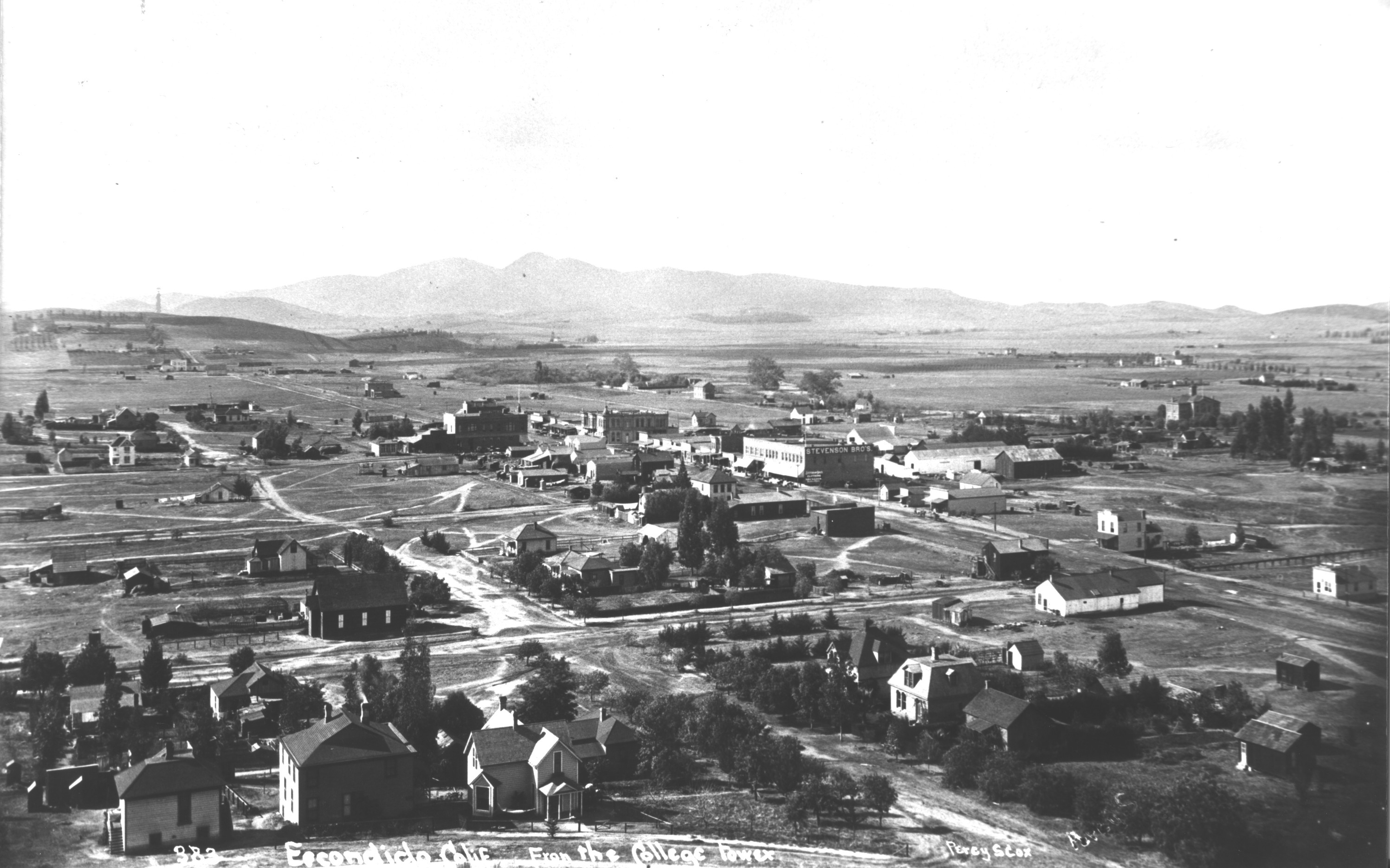
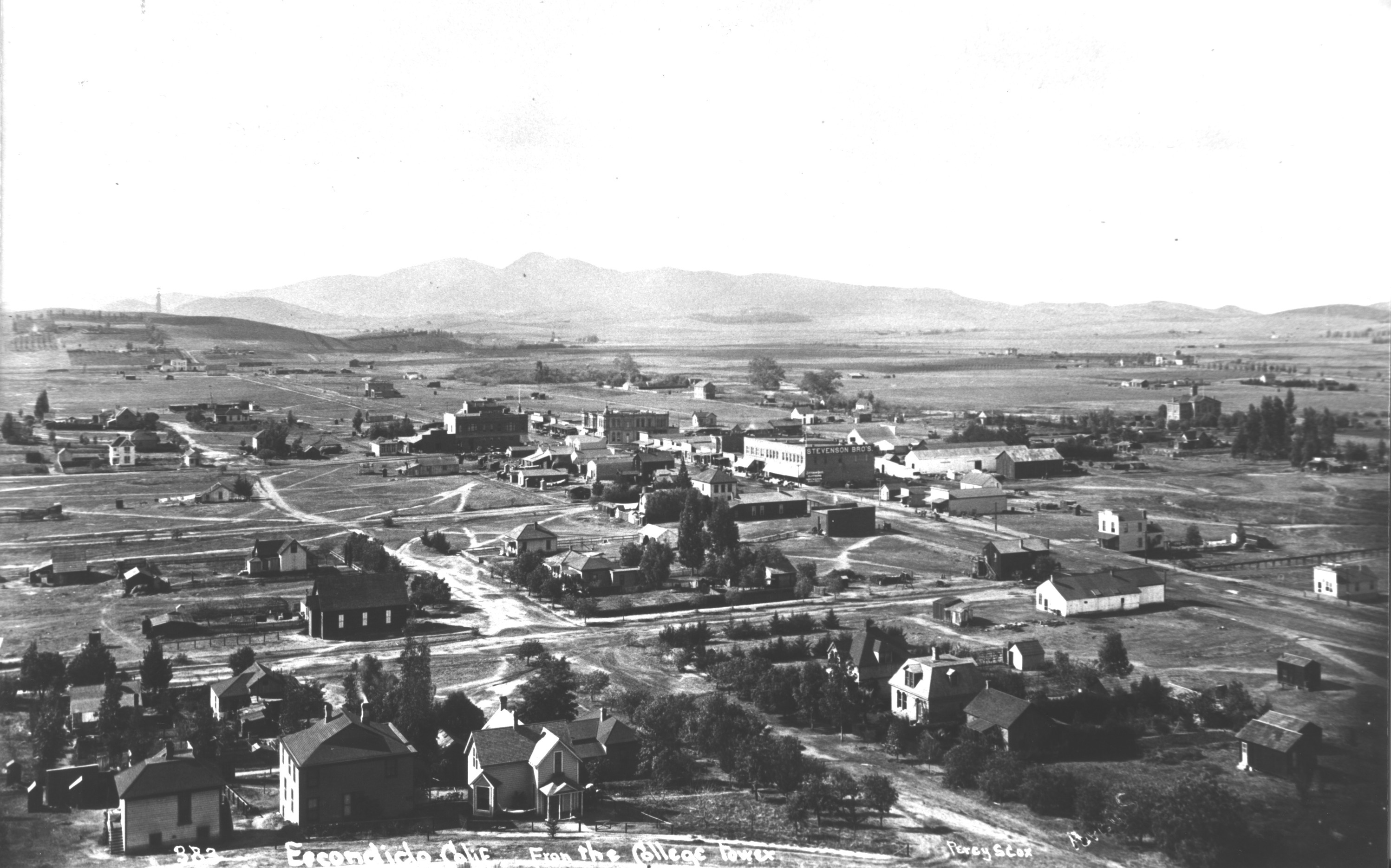
  8. An elevated black-and-white view across sparse buildings and roads in early Escondido.

    Capítulo 8 de 19 · Tierras, ciudad y gobierno

    1886

    La Escondido Land Company comenzó a dividir la tierra

    La revisión de la Ciudad dice que la Escondido Land Company comenzó a subdividir terrenos en 1886. Este relato de urbanización describe un cambio de propiedad y desarrollo; no marca el comienzo de la historia local.

    Fuentes: City of Escondido Cultural and Paleontological Resources (City of Escondido)

    Lee la historia con fuentes

    Contexto y crédito de la imagen (en inglés)

    This undated elevated photograph shows a sparsely built Escondido. The History Center page identifies it only as file 688. It is early-town context, not an 1886 plat map, the identified land-company tract, or evidence of original property ownership.

    An elevated historical view of Escondido. The source page does not provide a date or caption beyond the file name.

    Crédito
    Escondido History Center, file 688; photographer not identified on source page.
    Creador
    Photographer not identified on source page
    Licencia
    Rights unknown; owner-attributed use
    Fuente
    https://www.escondidohistory.org/photographs-collection
    Original
    https://static.wixstatic.com/media/5952e0_b6b9de4353694108bae4edc5d29be4de~mv2.jpg
    Reutilización
    Displayed only on Escondidopedia’s History of Escondido page and timeline with source attribution and link-back; remove on a substantiated publisher or rights-holder request.
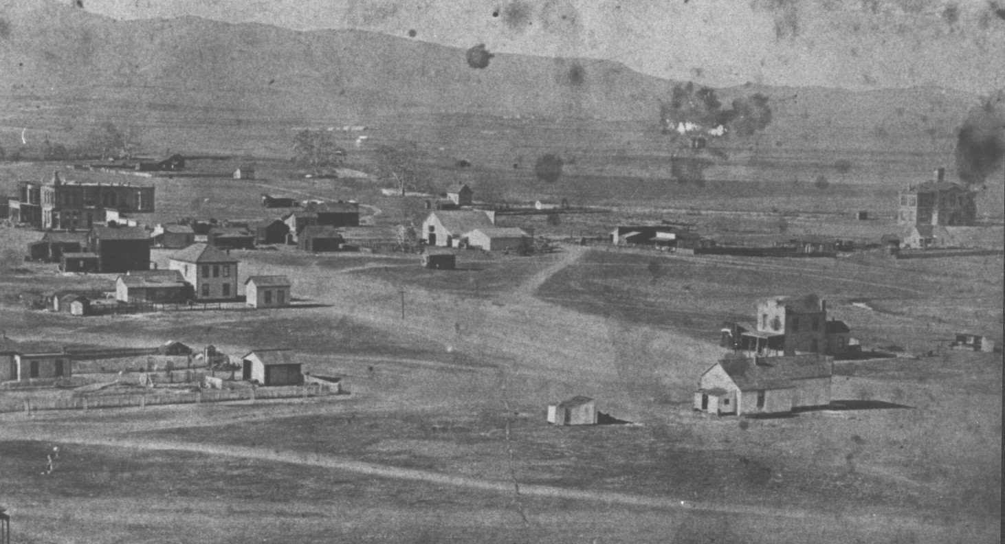
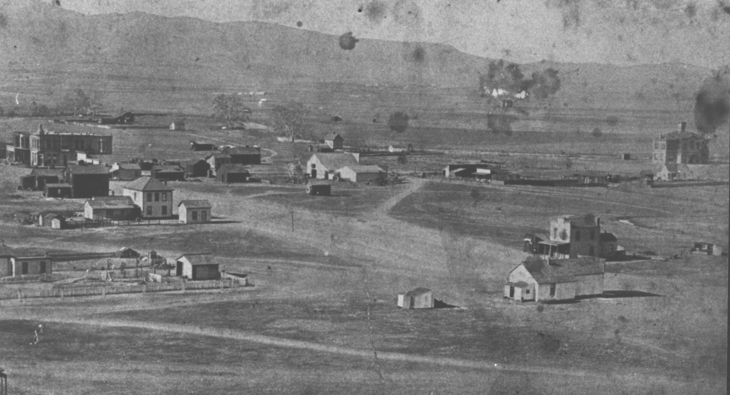
  9. An early Escondido neighborhood of scattered houses and open lots beneath low hills.

    Capítulo 9 de 19 · Tierras, ciudad y gobierno

    Desde mediados de la década de 1880

    Old Escondido creció por etapas

    Una revisión de la Ciudad describe unas 900 casas del distrito construidas desde mediados de la década de 1880 hasta 2012. Las casas victorianas, Craftsman, art déco y de la posguerra reflejan distintos periodos; la fecha de una casa requiere investigación específica.

    Fuentes: City of Escondido Cultural and Paleontological Resources (City of Escondido)

    Lee la historia con fuentes

    Contexto y crédito de la imagen (en inglés)

    This undated historical photograph shows scattered homes and open lots in Escondido. The History Center page provides catalog number 165 but no date. It is neighborhood-growth context, not a construction-date record for any individual house.

    An elevated historical view of homes and open lots in Escondido. The source page provides catalog #165 but no date.

    Crédito
    Escondido History Center, catalog #165; photographer not identified on source page.
    Creador
    Photographer not identified on source page
    Licencia
    Rights unknown; owner-attributed use
    Fuente
    https://www.escondidohistory.org/photographs-collection
    Original
    https://static.wixstatic.com/media/5952e0_a29c846f0e924113a922145b3a22c9b7~mv2.jpg
    Reutilización
    Displayed only on Escondidopedia’s History of Escondido page and timeline with source attribution and link-back; remove on a substantiated publisher or rights-holder request.
  10. Black-and-white side view of Escondido’s wooden Santa Fe depot beside railroad tracks, with people and rail cars nearby.

    Capítulo 10 de 19 · Tierras, ciudad y gobierno

    Enero de 1888

    El servicio ferroviario llegó a Escondido

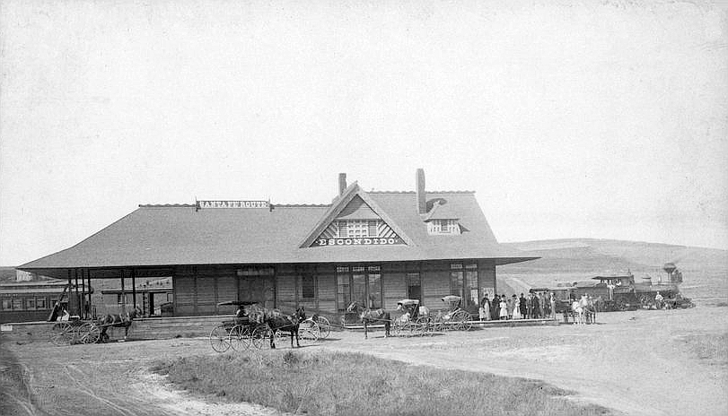
    La revisión de la Ciudad dice que Escondido recibió servicio ferroviario en 1888. Es un hito de transporte, no un relato completo de los trabajadores, negocios o cambios de tierras vinculados al ferrocarril.

    Fuentes: City of Escondido Cultural and Paleontological Resources (City of Escondido)

    Lee la historia con fuentes

    Contexto y crédito de la imagen (en inglés)

    J. E. Slocum photographed Escondido's Santa Fe depot circa 1887–1889. The approximate date places the image near the arrival of rail service, but it does not establish the exact day, workers, passengers, or operations involved.

    The Atchison, Topeka and Santa Fe Railway depot in Escondido, photographed circa 1887–1889.

    Crédito
    J. E. Slocum, circa 1887–1889. Kansas Memory, via Wikimedia Commons.
    Creador
    J. E. Slocum
    Licencia
    Public domain (United States)
    Fuente
    https://commons.wikimedia.org/wiki/File:Atchison,_Topeka_and_Santa_Fe_Railway_depot_-_Escondido,_California.jpg
    Original
    https://upload.wikimedia.org/wikipedia/commons/9/94/Atchison%2C_Topeka_and_Santa_Fe_Railway_depot_-_Escondido%2C_California.jpg
    Reutilización
    Public domain in the United States. Retain the approximate date and source; do not infer the identities of people shown or undocumented station operations.
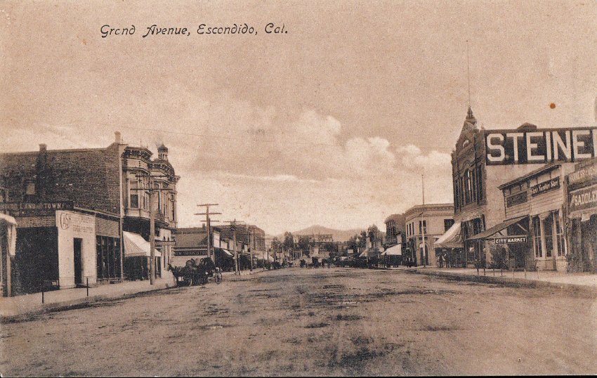
  11. A broad unpaved Grand Avenue lined with early storefronts.

    Capítulo 11 de 19 · Tierras, ciudad y gobierno

    1888

    Escondido se incorporó como ciudad

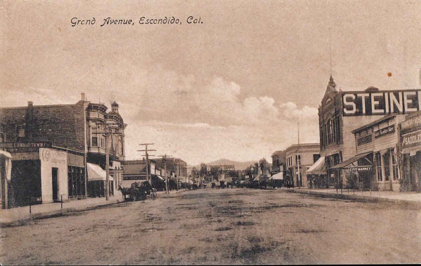
    La revisión de la Ciudad fecha la incorporación de Escondido en 1888. La incorporación creó un gobierno municipal; no creó la comunidad ni borró las historias anteriores.

    Fuentes: City of Escondido Cultural and Paleontological Resources (City of Escondido)

    Lee la historia con fuentes

    Contexto y crédito de la imagen (en inglés)

    This undated historical postcard shows an unpaved Grand Avenue lined with early storefronts. The History Center page provides catalog number 336 but no date. It does not depict the incorporation meeting, municipal building, or officials involved in the 1888 decision.

    A historical postcard view labeled “Grand Avenue, Escondido, Cal.” The source page provides catalog #336 but no date.

    Crédito
    Escondido History Center, catalog #336; photographer not identified on source page.
    Creador
    Photographer not identified on source page
    Licencia
    Rights unknown; owner-attributed use
    Fuente
    https://www.escondidohistory.org/photographs-collection
    Original
    https://static.wixstatic.com/media/5952e0_0972a0ed78af4885a6923e1a2ccc9274~mv2.jpg
    Reutilización
    Displayed only on Escondidopedia’s History of Escondido page and timeline with source attribution and link-back; remove on a substantiated publisher or rights-holder request.
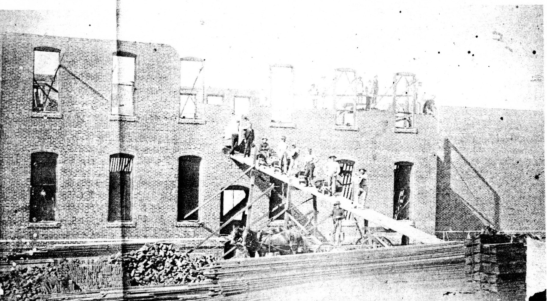
  12. Historic black-and-white photograph of workers on a temporary ramp and scaffolding outside a brick building under construction.

    Capítulo 12 de 19 · Experiencia inmigrante

    1886 a 1912

    Inmigrantes chinos construyeron, fabricaron ladrillos y administraron negocios

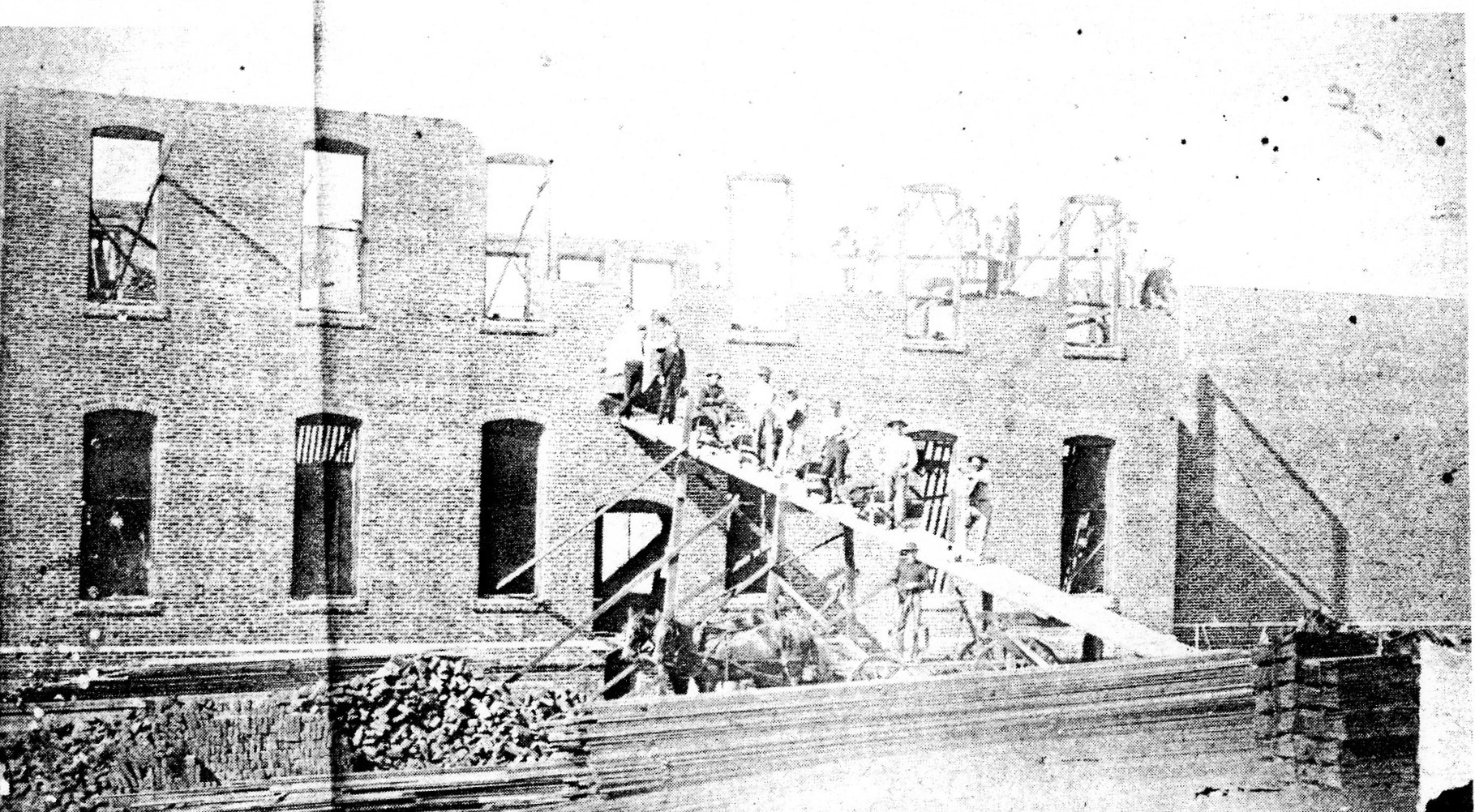
    Un proyecto estudiantil de CSUSM basado en fotografías de la Sala de los Pioneros identifica a trabajadores chinos construyendo Stevenson Bros. Department Store en 1890 y fabricando ladrillos usados en una iglesia en 1886. También registra la lavandería china de Sam Key en un anuncio de 1912.

    Fuentes: Asian Immigrants in Escondido: Photo Gallery (California State University San Marcos student project)

    Lee la historia con fuentes

    Contexto y crédito de la imagen (en inglés)

    This 1890 Pioneer Room photograph, as captioned by the CSUSM project, shows Chinese workers constructing Stevenson Bros. Department Store at Kalmia and Grand. The source does not name the photographer or individual workers.

    Chinese workers constructing the Stevenson Bros. Department Store at Kalmia Street and Grand Avenue in 1890, according to the CSUSM project’s Pioneer Room caption.

    Crédito
    Photographer not stated, 1890. Courtesy of the Pioneer Room, Escondido Public Library, via the CSUSM Asian Immigrants in Escondido project; public domain in the United States.
    Creador
    Photographer not stated
    Licencia
    Public domain in the United States (1890 photograph)
    Fuente
    https://wp.csusm.edu/escondido-newspapers/photo-gallery/
    Original
    https://wp.csusm.edu/escondido-newspapers/wp-content/uploads/sites/15/2022/02/1-chinese-workers.jpg
    Reutilización
    The photograph is public domain in the United States based on its 1890 creation date; retain the source attribution and do not assign names or roles to individual workers beyond the source caption.
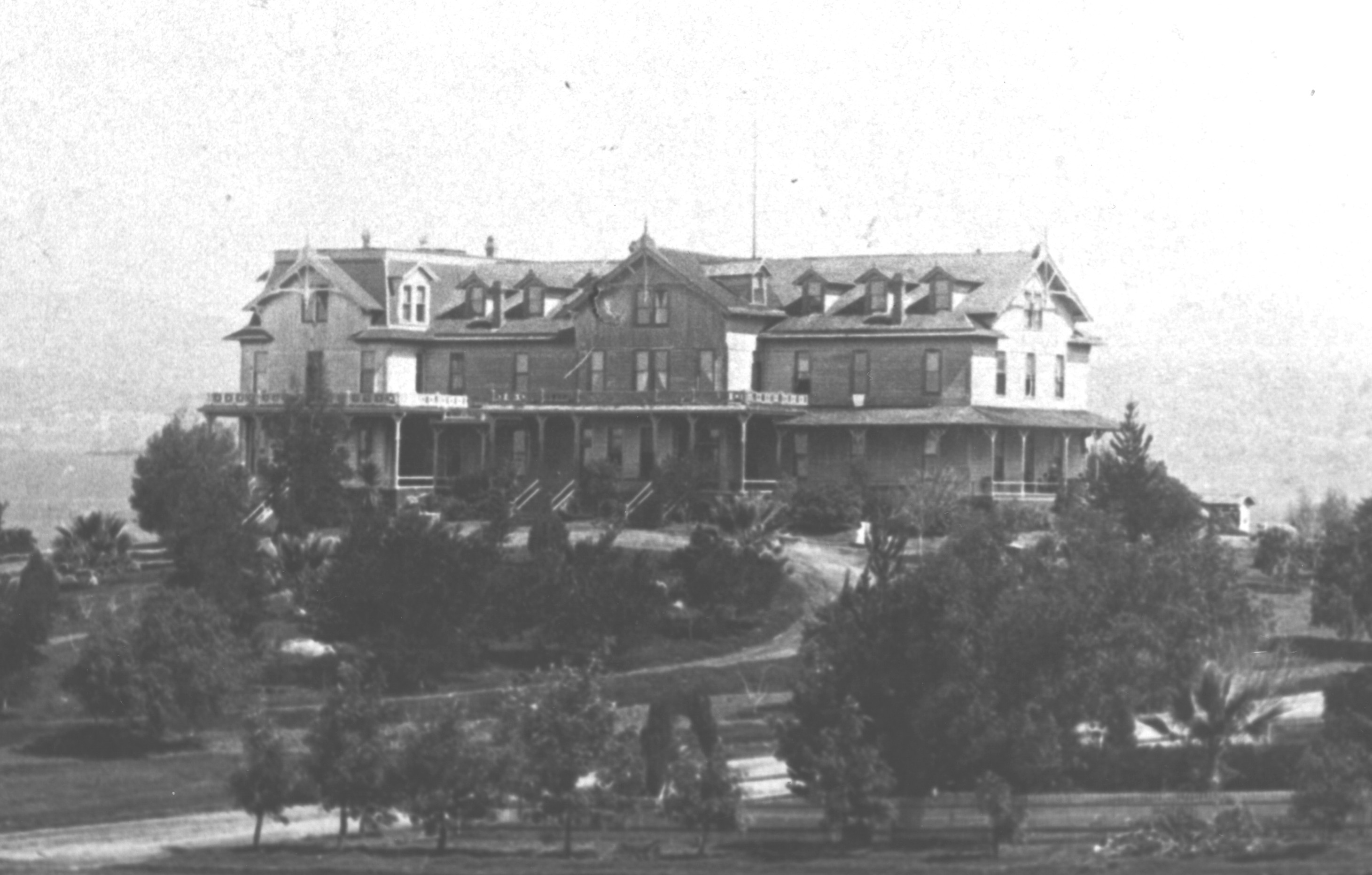
  13. A large Victorian-era hotel on a landscaped hillside.

    Capítulo 13 de 19 · Experiencia inmigrante

    1893

    Cocineros japoneses trabajaron en el Hotel Escondido

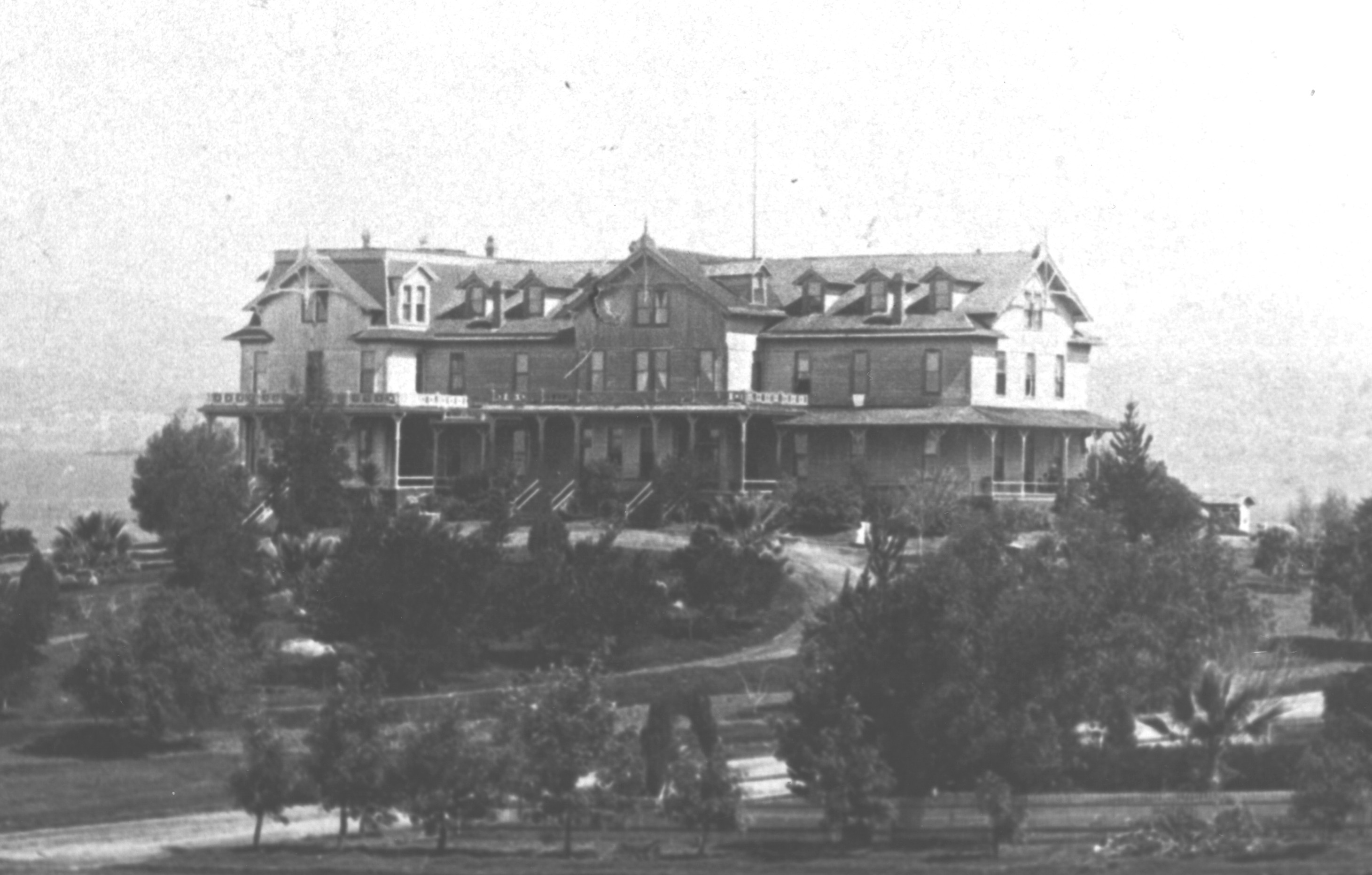
    El proyecto de CSUSM dice que el Hotel Escondido empleó a cocineros chinos y japoneses alrededor de 1893. Nombra a B. Itusga, un cocinero japonés que hacía canastas de fruta y decoraba habitaciones con raíces de manzanita.

    Fuentes: Asian Immigrants in Escondido: Photo Gallery (California State University San Marcos student project)

    Lee la historia con fuentes

    Contexto y crédito de la imagen (en inglés)

    This History Center photograph shows Hotel Escondido, the workplace named in this chapter. The collection page does not date the image or identify the photographer, and the photograph does not identify B. Itusga or the hotel's cooks.

    A view of Hotel Escondido, built by the Escondido Land and Town Company. The source page does not provide a date.

    Crédito
    Escondido History Center, catalog #46; photographer not identified on source page.
    Creador
    Photographer not identified on source page
    Licencia
    Rights unknown; owner-attributed use
    Fuente
    https://www.escondidohistory.org/photographs-collection
    Original
    https://static.wixstatic.com/media/5952e0_a4fadcb2120c4438b09d00be56a4edad~mv2.jpg
    Reutilización
    Displayed only on Escondidopedia’s History of Escondido page and timeline with source attribution and link-back; remove on a substantiated publisher or rights-holder request.
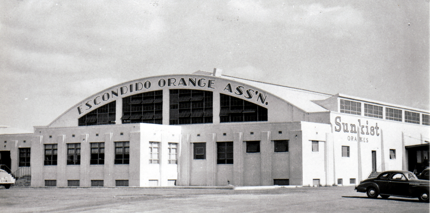
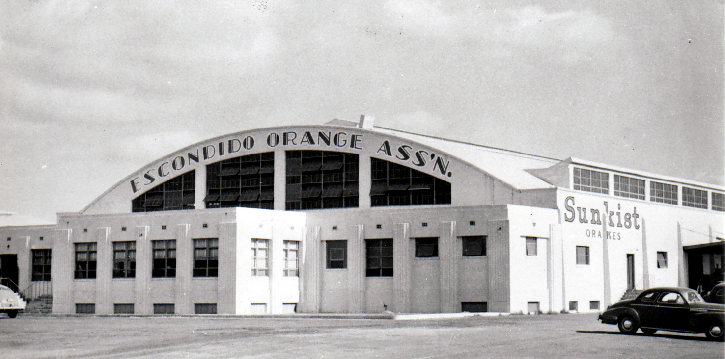
  14. The white Escondido Orange Association packing-house facade with Sunkist signs.

    Capítulo 14 de 19 · Tierras, ciudad y gobierno

    1888 a 1960

    Huertos y empacadoras impulsaron un auge agrícola

    La revisión de la Ciudad relaciona el ferrocarril con la expansión de exportaciones agrícolas. Las uvas y los cítricos impulsaron el crecimiento, y algunos huertos luego se convirtieron en plantaciones de aguacate. Trabajadores filipinos cosechaban y empacaban limones para la Escondido Lemon Association.

    Fuentes: City of Escondido Cultural and Paleontological Resources (City of Escondido) · Asian Immigrants in Escondido: Photo Gallery (California State University San Marcos student project)

    Lee la historia con fuentes

    Contexto y crédito de la imagen (en inglés)

    This undated History Center photograph shows the Escondido Orange Association packing-house facade with Sunkist signage. The collection page provides catalog number 421 but no date. It documents one agricultural business, not every crop, company, or worker in the wider boom.

    The Escondido Orange Association Sunkist packing-house building. The source page provides catalog #421 but no date.

    Crédito
    Escondido History Center, catalog #421; photographer not identified on source page.
    Creador
    Photographer not identified on source page
    Licencia
    Rights unknown; owner-attributed use
    Fuente
    https://www.escondidohistory.org/photographs-collection
    Original
    https://static.wixstatic.com/media/5952e0_928b303360154af28802d01752383226~mv2.jpg
    Reutilización
    Displayed only on Escondidopedia’s History of Escondido page and timeline with source attribution and link-back; remove on a substantiated publisher or rights-holder request.
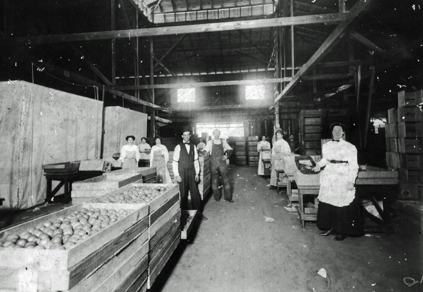
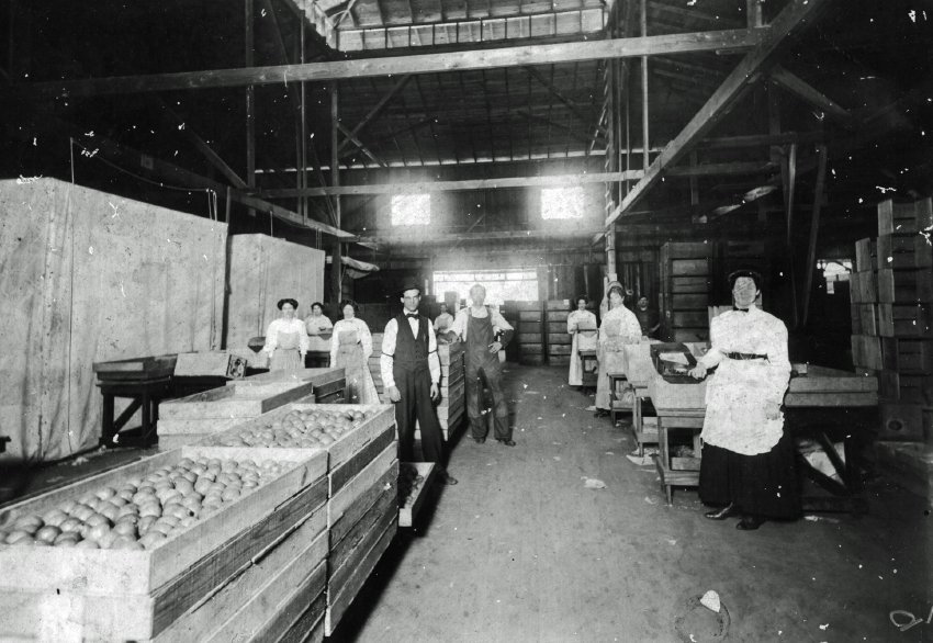
  15. Workers stand among long rows of produce bins inside an Escondido packing facility.

    Capítulo 15 de 19 · Experiencia inmigrante

    1931 y durante la década de 1930

    Residentes filipinos trabajaron y formaron comunidad

    El proyecto de CSUSM registra que Alex Agatep se mudó a Escondido en 1931 y trabajó largas jornadas cosechando limones. Otros migrantes filipinos cosechaban y empacaban para la asociación. Una reunión del Día de Rizal de 1932 muestra vida comunitaria más allá del trabajo agrícola.

    Fuentes: Asian Immigrants in Escondido: Photo Gallery (California State University San Marcos student project)

    Lee la historia con fuentes

    Contexto y crédito de la imagen (en inglés)

    This undated History Center photograph shows people working inside an Escondido produce-packing facility. The collection page does not identify the workers, so the image must not be read as identifying them as Filipino or as a portrait of Alex Agatep. It provides local packing-work context only.

    People working inside an Escondido produce-packing facility. The source page provides catalog #396 but does not identify the people or date.

    Crédito
    Escondido History Center, catalog #396; photographer and people not identified on source page.
    Creador
    Photographer not identified on source page
    Licencia
    Rights unknown; owner-attributed use
    Fuente
    https://www.escondidohistory.org/photographs-collection
    Original
    https://static.wixstatic.com/media/5952e0_1ef7f16ec2c04b319e040bbe3a3f1401~mv2.jpg
    Reutilización
    Displayed only on Escondidopedia’s History of Escondido page and timeline with source attribution and link-back; remove on a substantiated publisher or rights-holder request.
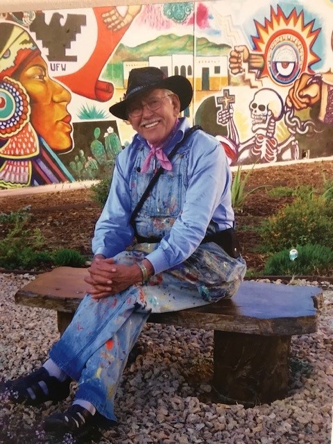
  16. Portrait of muralist Salvador R. Torres seated on a bench with a colorful Chicano Park mural behind him.

    Capítulo 16 de 19 · Historia latina

    1990

    Estudiantes y artistas convirtieron la historia local en un mural comunitario

    El archivo Mexican American Art Since 1848 fecha el Escondido Historical Mural en 1990. Da crédito a 35 estudiantes y docentes de escuelas y universidades locales y dice que Salvador y Gloria Torres interpretaron los diseños estudiantiles mientras la Felicita Foundation convocó reuniones comunitarias. La imagen del mural con derechos de autor no se reproduce aquí.

    Fuentes: Escondido Historical Mural (Mexican American Art Since 1848, University of Minnesota)

    Lee la historia con fuentes

    Contexto y crédito de la imagen (en inglés)

    This 2022 portrait shows muralist Salvador R. Torres at Chicano Park. Torres helped interpret student designs for the Escondido mural; the background art is not that mural, whose archival image remains withheld because its record requires permission.

    Muralist Salvador R. Torres at Chicano Park in 2022. Torres helped interpret student designs for Escondido’s 1990 historical mural; this photograph does not show that mural.

    Crédito
    Photo by Dboxell, CC BY-SA 4.0, via Wikimedia Commons.
    Creador
    Dboxell
    Licencia
    CC BY-SA 4.0
    Fuente
    https://commons.wikimedia.org/wiki/File:SRTORRES2.jpg
    Original
    https://upload.wikimedia.org/wikipedia/commons/e/eb/SRTORRES2.jpg
    Reutilización
    Reuse under CC BY-SA 4.0 with attribution and share-alike terms; do not imply endorsement or confuse the background Chicano Park art with the restricted Escondido Historical Mural.
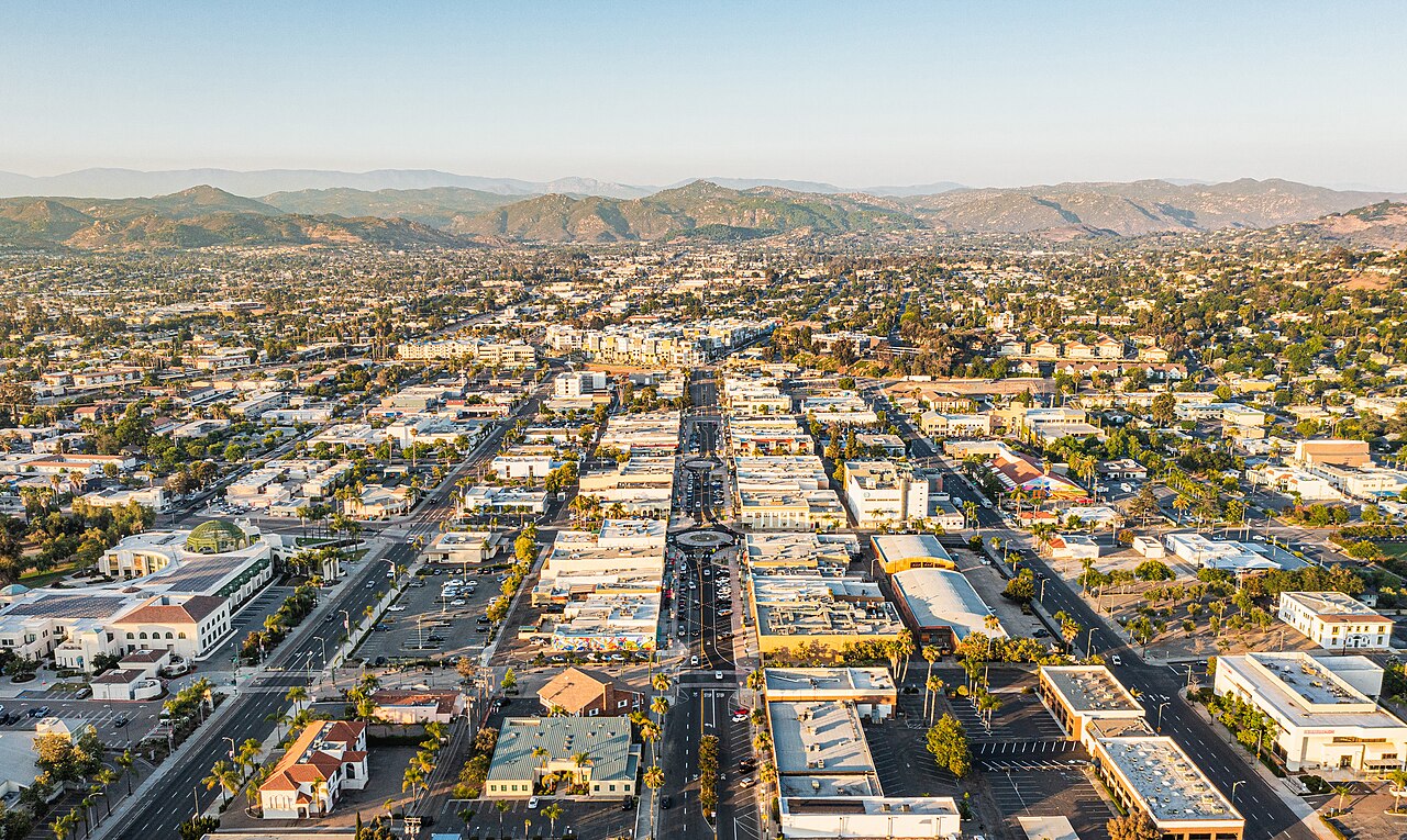
  17. Aerial view looking northeast along Grand Avenue through downtown Escondido toward surrounding hills.

    Capítulo 17 de 19 · Tierras, ciudad y gobierno

    2015 a junio de 2025

    Un plan para Grand Avenue pasó de la propuesta a dos fases terminadas

    Una página de la Ciudad dice que comerciantes y participantes del centro pidieron revitalizar Grand Avenue en 2015. El Concejo Municipal aprobó el plan en 2018 y la Ciudad informa que dos fases terminaron en 2022 y junio de 2025. Son hitos declarados por la Ciudad, no una evaluación de sus efectos.

    Fuentes: City of Escondido Grand Avenue Vision Project page (City of Escondido)

    Lee la historia con fuentes

    Contexto y crédito de la imagen (en inglés)

    This July 2025 aerial photograph looks northeast along Grand Avenue after the City-reported completion date. It shows the corridor but does not by itself measure the project's effects.

    Grand Avenue and downtown Escondido, facing northeast in July 2025.

    Crédito
    Photo by CaliforniaUrbanist, CC BY-SA 4.0, via Wikimedia Commons. Local copy uses Wikimedia's 1280px resized file; no Escondidopedia edits.
    Creador
    CaliforniaUrbanist
    Licencia
    CC BY-SA 4.0
    Fuente
    https://commons.wikimedia.org/wiki/File:Historic_Downtown_Escondido_Grand_Avenue_July_2025,_Facing_Northeast.jpg
    Original
    https://upload.wikimedia.org/wikipedia/commons/thumb/1/14/Historic_Downtown_Escondido_Grand_Avenue_July_2025%2C_Facing_Northeast.jpg/1280px-Historic_Downtown_Escondido_Grand_Avenue_July_2025%2C_Facing_Northeast.jpg
    Reutilización
    Reuse under CC BY-SA 4.0 with attribution, license link, share-alike for adaptations, and change indication if modified.
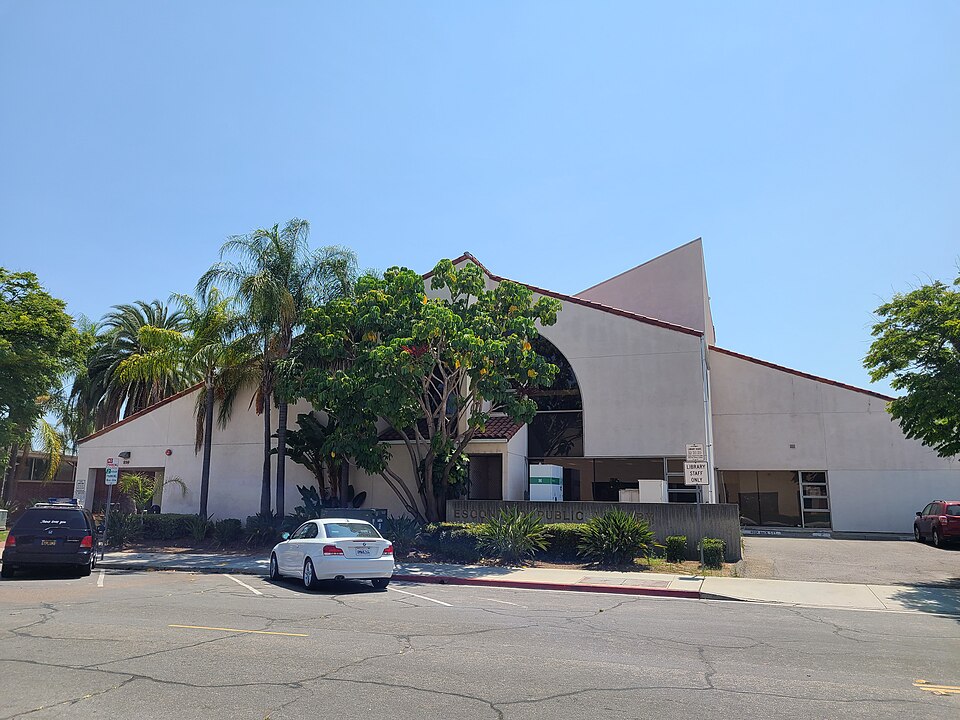
  18. Street view of the Escondido Public Library building on Kalmia Street.

    Capítulo 18 de 19 · Historia latina

    Activo en 2026

    La Sala de los Pioneros está formando una colección de historia oral latina

    La página actual de la Ciudad dice que la Sala de los Pioneros entrevista activamente a personas vinculadas con Escondido e invita a participar en Latinos in Escondido Oral History Project para ampliar sus colecciones latinas. Aquí no se usa contenido de entrevistas sin publicar.

    Fuentes: Donations — Pioneer Room (City of Escondido)

    Lee la historia con fuentes

    Contexto y crédito de la imagen (en inglés)

    This present-day photograph shows the Escondido Public Library, home of the Pioneer Room. It does not show an interview, participant, or collection item.

    Escondido Public Library on Kalmia Street.

    Crédito
    Photo by Alan Islas, CC BY-SA 4.0, via Wikimedia Commons. Local copy uses Wikimedia's 960px resized file; no Escondidopedia edits.
    Creador
    Alan Islas
    Licencia
    CC BY-SA 4.0
    Fuente
    https://commons.wikimedia.org/wiki/File:Escondido_Public_Library.jpg
    Original
    https://upload.wikimedia.org/wikipedia/commons/thumb/0/05/Escondido_Public_Library.jpg/960px-Escondido_Public_Library.jpg
    Reutilización
    Reuse under CC BY-SA 4.0 with attribution, license link, share-alike for adaptations, and change indication if modified.
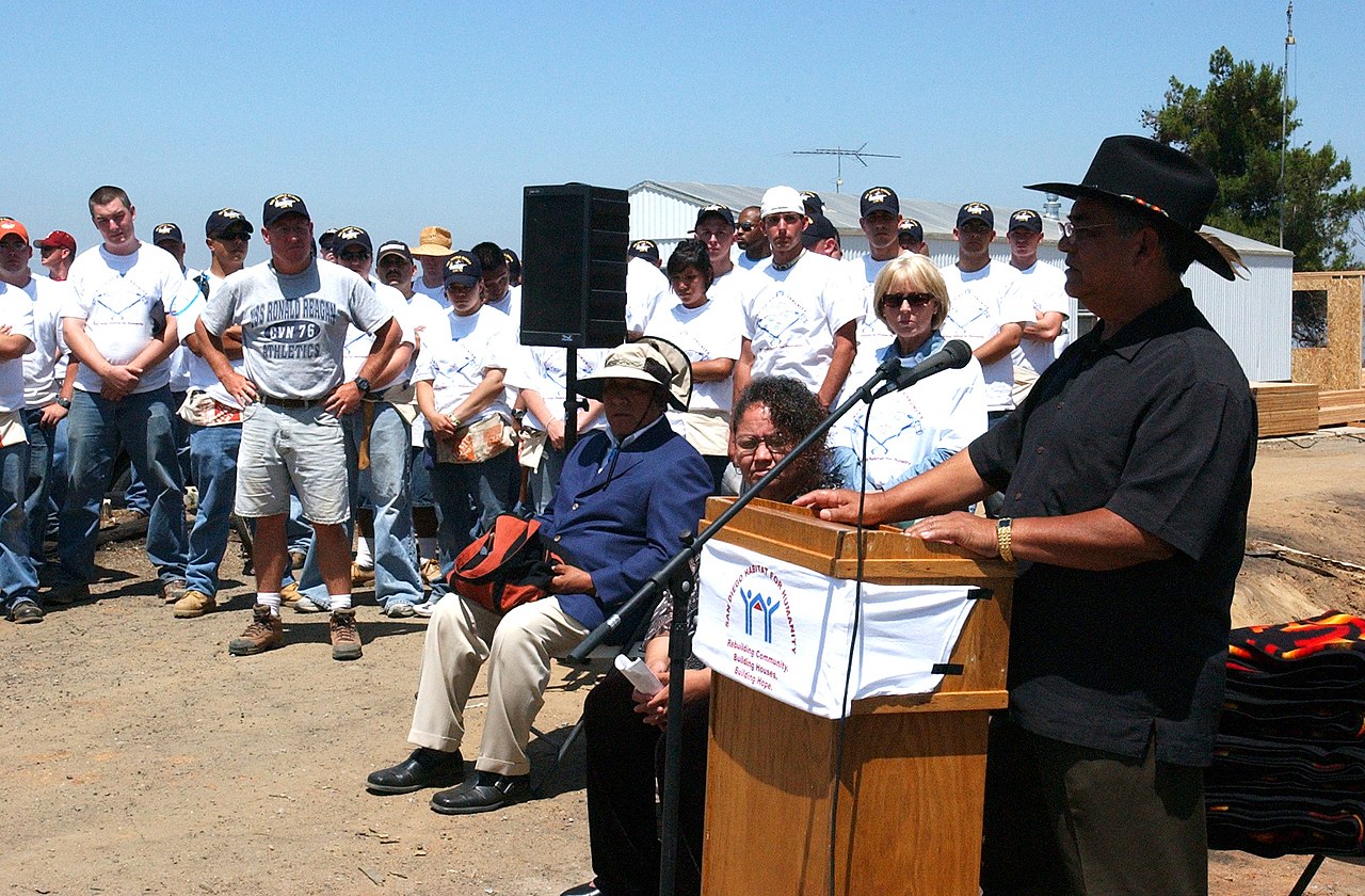
  19. Allen Lawson speaks at a podium during a 2004 community home-building event while participants stand behind him.

    Capítulo 19 de 19 · Memoria viva

    Hoy

    La cultura Kumeyaay y la memoria comunitaria siguen siendo trabajo vivo

    La Banda de San Pasqual describe reuniones actuales, cantos de aves, juegos tradicionales y aprendizaje del idioma. El proyecto de CSUSM hace visibles historias de inmigrantes chinos, japoneses y filipinos, mientras la Sala de los Pioneros amplía activamente su colección de historia oral latina. Ninguna está encerrada en el pasado.

    Fuentes: Culture (San Pasqual Band of Mission Indians) · Asian Immigrants in Escondido: About (California State University San Marcos) · Donations — Pioneer Room (City of Escondido)

    Lee la historia con fuentes

    Contexto y crédito de la imagen (en inglés)

    This 2004 Navy photograph shows then–San Pasqual Tribal Chairman Allen Lawson speaking at a Habitat for Humanity event. It represents Tribal leadership in public community life, not current office or every cultural and oral-history practice named in this chapter.

    Then–San Pasqual Tribal Chairman Allen Lawson welcomes participants at a 2004 Habitat for Humanity event in San Diego. The public-role image shows Tribal leadership in community life; it does not depict every cultural practice named in this chapter.

    Crédito
    U.S. Navy photo by Deris Jeannette, 23 June 2004, via Wikimedia Commons; public domain in the United States. Local copy uses Wikimedia's 1280px resized file; no Escondidopedia edits.
    Creador
    U.S. Navy photo by Deris Jeannette
    Licencia
    Public domain (United States Navy work)
    Fuente
    https://commons.wikimedia.org/wiki/File:US_Navy_040623-N-8770J-001_Nimitz-Class_aircraft_carrier_USS_Ronald_Reagan_(CVN_76)_Sailors_watch_as_San_Pasqual_Tribal_Chairman_Allen_Lawson,_welcomes_guests_to_the_media_availability_for_a_Habitat_for_Humanities_project,_%5Eldq.jpg
    Original
    https://upload.wikimedia.org/wikipedia/commons/thumb/9/99/US_Navy_040623-N-8770J-001_Nimitz-Class_aircraft_carrier_USS_Ronald_Reagan_%28CVN_76%29_Sailors_watch_as_San_Pasqual_Tribal_Chairman_Allen_Lawson%2C_welcomes_guests_to_the_media_availability_for_a_Habitat_for_Humanities_project%2C_%5Eldq.jpg/1280px-thumbnail.jpg
    Reutilización
    Public-domain U.S. Navy work; retain the 2004 date and former-role wording, and do not imply current office, endorsement, or that the event is a cultural ceremony.

El archivo completo de registros fechados está disponible en inglés; no es una historia completa.

Explora la memoria local

Tres caminos para entrar, todos creados a partir de páginas publicadas y fuentes revisadas.

Personas e historias compartidas

Conoce a personas y explora recursos revisados de historia oral y memoria comunitaria.

Lugares que formaron Escondido

Explora sitios históricos, lugares emblemáticos y espacios de reunión vinculados con la memoria local.

Arte y memoria pública

Descubre arte público, organizaciones culturales y obras creativas revisadas en Escondido.

Investiga los registros

Documentos fuente, colecciones y registros oficiales para investigar y verificar.

Todas las páginas revisadas disponibles en español

Estas listas se actualizan automáticamente cuando una traducción revisada se publica o se retira.

Personas e historias compartidas

Lugares que formaron Escondido

Arte y memoria pública

Vista ampliada de la imagen

Crédito:

Ver fuente